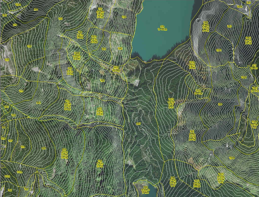
Our GIS team plays a crucial role in every stage of project planning, analysis, and reporting. We specialize in advanced spatial analysis and expert-level cartographic design, customized to meet the needs of our clients and project stakeholders. This commitment to excellence provides our clients with practical tools that enhance decision-making and support regulatory compliance.
Madrone’s GIS team is seamlessly integrated into multidisciplinary projects across all the sectors in which Madrone is active. From modeling wildlife habitat suitability to watershed assessments, we deliver spatial solutions that support both ecological integrity and project feasibility. We also maintain data management practices, ensuring consistency and traceability from field data collection through to final reporting. This comprehensive approach allows our team to respond quickly to evolving project needs and provide robust, sound outputs that stand up to technical review and regulatory scrutiny.
The quality of our GIS services stems from our use of current tools and technologies – including ArcGIS Pro, ArcGIS Online, Python scripting, and imagery – to deliver precise, reliable, and actionable outputs. Our team manages and analyzes large geospatial datasets, extracts key insights, and produces maps and spatial models that communicate findings clearly and effectively to clients, Indigenous partners, and regulators alike
Selection of Services
- Integration of remote sensing data (e.g., satellite imagery, drone data) for advanced spatial analysis
- Creation of 3D models and visualizations to support project planning and decision
making - Development and maintenance of dynamic, real-time GIS dashboards for project
tracking and stakeholder engagement - Proficiency in spatial modeling and predictive analytics for environmental and
infrastructure projects
- Collaboration with Indigenous partners and stakeholders to ensure culturally appropriate
and accurate mapping - Implementation of data quality assurance (QA) protocols and validation checks to
maintain high standards of GIS data integrity - Design and management of geospatial databases for large-scale, long-term projects
- Training and mentorship of staff and stakeholders in GIS tools, technologies, and best
practices